


Ten years in the making: TOH addresses best practices for protecting and restoring Crab Meadow Watershed
Last month, the Town of Huntington released the final draft of the “Crab Meadow Watershed Hydrology Study and Stewardship Plan,” a community-driven land management tool that was created to highlight best practices in future management of the town's largest watershed.
The plan has been in the works since 2012, just before Superstorm Sandy hit Long Island and revealed even more vulnerabilities to the local watershed system than what was initially understood. In 2014, the initiative was introduced to town residents at the Northport Public Library, and several meetings and presentations have been held since. This year, the final draft has been released to the public for viewing and additional commentary. “Accepting this stewardship plan will help guide the Town and future administrations on implementing policies that are in the best interests of our local environment, including one of Northport’s most fragile wetland habitats,” stated Town of Huntington Supervisor Ed Smyth.
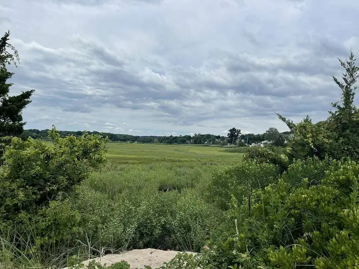
Crab Meadow is a designated Long Island Sound Study Stewardship Area, comprising about six square miles of downward sloping land that leads to a 400-acre tidal marsh known as the Jerome A. Ambro Memorial Wetland. This estuary receives run-off from upland areas as far south as the Northport Veterans Administration property in Northport.
The watershed is an interconnected land system of glacially formed features that drain to the Long Island Sound. “As the easternmost and largest coastal wetland expanse in the Town of Huntington, the Crab Meadow Watershed serves as a sentinel landmark,” reads the study.
The study area is bordered to the west by the Villages of Northport and Asharoken, to the east by the Town of Smithtown (Fresh Pond), and is loosely bounded by Bellerose Avenue to the south. All of these areas impact the Crab Meadow Watershed, including water from tunnel valleys as far as Vernon Valley Road, Bread and Cheese Hollow Road, Town Line Road and Stony Hollow Road.
The plan was developed for use as a land management tool, serving to identify initial strategies to maintain and enhance local watershed resources, and highlighting protective and restorative measures for enhancing our local ecosystem and natural resources.
There are several strategic goals suggested in the plan. They focus on community involvement and education; habitat, plants and wildlife; water resources and water quality; access and recreation; land use; and infrastructure, restoration and historic resources.
Some of the goals presented include the following:
Raise overall public awareness and stewardship
Improve educational resources and outreach
Monitor protected areas to detect changes
Manage, control or eliminate invasive plant species and nuisance wildlife
Protect key nesting areas from recreational uses
Calm traffic in proximity of park access points and at known wildlife crossings
Implement best management practices/green infrastructure to stem flooding, maximize infiltration, mitigate impacts to natural resources
Define baseline conditions in surface waters and groundwater and strive to improve water quality
Continue seasonal beach clean-up days to marsh and upland parks to remove floatables and litter
Provide sufficient parking and safe access to trails and all park resources
Encourage major stakeholders/owners of critical holdings and individual owners to participate in watershed protection actions
Stem vandalism and nuisance uses
Implement sustainable upgrade to Cranberry Hill Environmental Center to enable year-round use
Develop exhibits and signage to interpret cultural and natural history of CMW
The 112-page plan can be viewed here and public comment can be submitted here. Some interesting sections of the study that pertain to Northport-East Northport residents are the sections regarding local wildlife habitats and nesting sites (page 53), resident runoff pollution (page 76), urbanization or development effects (page 78), and site-specific recommendations for improving water quality and the ecosystem, including the removal of invasive species and installing stormwater collection systems (page 80).
Don’t miss a story
Get the latest news delivered to your inbox.


